7 Best-Selling Atlas Books Millions Love
Curated by Paul Graham, National Geographic, and Library Journal for readers seeking trusted Atlas Books

There's something special about books that both critics and crowds love, especially in the rich world of atlases. Atlas books serve as more than mere maps; they are gateways to understanding geography, history, and adventure with proven value that millions embrace. Whether you're planning a cross-country trip or diving into ancient worlds, these atlases offer clarity and insight that stand the test of time.
Experts like Paul Graham, co-founder of Y Combinator, have praised works such as The New Penguin Atlas of Ancient History for its spatial storytelling that enriches historical knowledge. National Geographic, a leader in geographic exploration, highlights the vivid detail in Atlas of the National Parks, while Library Journal recognizes its depth for both visitors and scholars. These voices reflect a consensus on the enduring worth of these atlases.
While these popular books provide proven frameworks, readers seeking content tailored to their specific Atlas needs might consider creating a personalized Atlas book that combines these validated approaches. This way, you gain the best of expert recommendations and a focus uniquely suited to your goals and background.

What makes the Rand McNally Road Atlas Large Scale 2025 both expert-recommended and widely beloved is its commitment to clarity and usability for road travelers. Rand McNally has honed its craft over more than a century, creating maps that are 35% larger than standard atlases, making navigation easier on the go. You’ll find detailed city insets, national park maps, and practical tools like mileage charts and driving time maps that help plan trips across the U.S., Canada, and Mexico. This atlas suits anyone who values detailed, reliable cartographic information for road travel, whether planning a cross-country journey or weekend getaway.

by Karen Wynn Fonstad·You?
by Karen Wynn Fonstad·You?
While working as a cartographer and educator, Karen Wynn Fonstad crafted a unique visual journey through Tolkien's Middle-earth that goes far beyond simple maps. You gain detailed, day-by-day routes of iconic characters like Frodo and Bilbo, alongside strategic battle maps and intricate plans of castles, making it a rich resource for immersing yourself in Tolkien's world. The atlas also explores thematic elements such as climate and population distribution, helping you see Middle-earth not just as a story setting but as a complex, living geography. This book appeals most to serious Tolkien enthusiasts and scholars who want a deeper understanding of the geography behind the narrative.
by TailoredRead AI·
by TailoredRead AI·
This tailored book explores the essential methods and insights needed to confidently navigate and utilize atlases in various contexts. It reveals how to interpret complex cartographic information, understand geographical relationships, and apply atlas knowledge to real-world navigation and study. The content is crafted to match your background and specific goals, focusing on your interests in atlas mastery. By combining widely valued reader knowledge with personalized guidance, it offers a clear pathway to mastering atlas use without overwhelming you with unrelated details. This personalized approach makes learning engaging and efficient, helping you develop skills that fit your unique needs and curiosity about maps.
Recommended by National Geographic
“National Geographic’s Atlas of the National Parks showcases these natural treasures through photographs, maps, and graphics.”

by Jon Waterman··You?
by Jon Waterman··You?
Unlike most atlases that focus solely on navigation, Jon Waterman's extensive experience as a former park ranger in Alaska shapes this atlas into a vivid journey through America's national parks, combining detailed maps with rich photography and insightful narratives. You uncover not just locations but the unique ecosystems, historical tales, and geological wonders that define each park, such as the snowy peaks of Denali or the white sands of Dry Tortugas. Chapters delve into wildlife habitats, cultural heritage, and even climatic nuances, making it ideal if you want to deepen your understanding beyond mere geography. This book suits nature lovers and those curious about America's natural heritage, though casual travelers seeking quick guides might find it more detailed than necessary.
by Delorme·You?
by Delorme·You?
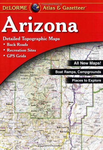
What happens when a publisher with decades of cartographic expertise turns its focus to state-level detail? Delorme developed the Arizona Atlas & Gazetteer to fill a niche for outdoor enthusiasts and travelers needing more than just standard road maps. You learn how to navigate Arizona’s back roads, identify prime fishing and hunting spots, and locate campgrounds and public lands through detailed topographic maps. This atlas benefits anyone from weekend adventurers to professionals planning business travel who require precise, layered geographic information not found in typical maps. Chapters highlight diverse features like wetlands, trailheads, and unique natural landmarks that enhance your planning and exploration.
![National Geographic Road Atlas 2025: Adventure Edition [United States, Canada, Mexico] book cover](https://m.media-amazon.com/images/I/51g+DvKGgYL._SL500_.jpg)
by National Geographic Maps··You?
by National Geographic Maps··You?
National Geographic Maps, with over a century of expertise in cartography, crafted this Road Atlas to guide your travels across the United States, Canada, and Mexico. You’ll find detailed road maps for all 50 states plus major cities and tourist hotspots, complemented by curated recommendations for the top 100 adventure destinations and 24 national parks. The atlas also includes practical resources like local tourism contacts and a place name index, making navigation and trip planning straightforward. If you’re someone who values both accuracy and adventure on the road, this atlas offers a durable, thoughtfully designed companion to elevate your journey.
by TailoredRead AI·
This tailored book explores the art and science of atlas reading through a step-by-step, personalized approach designed to match your background and interests. It focuses on building your map navigation skills efficiently, guiding you through key cartographic concepts, spatial awareness techniques, and practical exercises that align with your goals. By concentrating on the elements most relevant to your needs, this book reveals how to quickly interpret diverse map types and confidently navigate complex geographic information. With a personalized focus, it examines essential skills such as coordinate reading, topographic understanding, and thematic map analysis. The book emphasizes practical mastery through tailored lessons that help you gain a deep, intuitive grasp of atlas navigation in just 30 days.
Recommended by Paul Graham
Co-Founder of Y Combinator

by Colin McEvedy, John Woodcock·You?
by Colin McEvedy, John Woodcock·You?
After analyzing centuries of historical shifts, Colin McEvedy and John Woodcock developed a visual journey through ancient civilizations via maps that chronicle racial and cultural changes across Europe, the Mediterranean, and the Near East from 50,000 B.C. to the fourth century A.D. This atlas doesn't just show territories; it reveals the complex ebb and flow of peoples and empires, providing you with a spatial understanding of ancient history that textbooks alone rarely offer. Through its 128 pages, you'll gain insight into how geography shaped historical events and cultural interactions, making it invaluable for enthusiasts of ancient and world history alike. If you’re seeking a richly illustrated reference that connects geography and history seamlessly, this is a solid choice, though it's less suited for those wanting detailed narrative histories.

by Michelin·You?
by Michelin·You?
Michelin's Italy Road Atlas offers a straightforward yet well-thought-out resource for navigating Italy’s roads with confidence. Updated annually by dedicated teams, its maps include not only detailed routes but also handy locator maps that place each page within a broader geographic context, easing your sense of direction. You’ll find carefully selected scenic drives highlighted, along with practical city center maps, making this atlas particularly useful for travelers who want to explore beyond the highways. If you’re planning a road trip through Italy or simply need reliable, user-friendly maps that prioritize clarity and detail, this atlas is built with your journey in mind.
Proven Atlas Books, Personalized for You ✨
Get popular atlas strategies tailored to your unique travel and study needs.
Trusted by thousands of atlas enthusiasts and experts worldwide
Conclusion
The collection of atlases here offers a diverse blend of proven frameworks and widespread validation. Whether it's the expansive road detail of the Rand McNally Road Atlas Large Scale 2025 or the immersive fantasy cartography of the Atlas Of Middle-Earth, these books provide trusted paths for exploration and learning.
If you prefer proven methods for travel, start with the Rand McNally or National Geographic Road Atlases. For a validated approach to understanding history's spatial dimension, combine The New Penguin Atlas of Ancient History with the Atlas of the National Parks. Each book has earned its place through expert endorsements and reader appreciation.
Alternatively, you can create a personalized Atlas book to combine proven methods with your unique needs. These widely-adopted approaches have helped many readers succeed in navigating both the physical world and the stories within it.
Frequently Asked Questions
I'm overwhelmed by choice – which atlas should I start with?
Start with atlases that match your interests. For road travel, the Rand McNally Road Atlas Large Scale 2025 offers detailed North American maps. If history fascinates you, try The New Penguin Atlas of Ancient History. Choosing based on your goals helps you engage more deeply right away.
Are these atlases suitable for beginners?
Yes, many of these atlases, like the National Geographic Road Atlas 2025, are designed for users at all levels. They combine clear maps with accessible information, making them great for newcomers and experienced explorers alike.
Is it better to read these atlases in a specific order?
Not necessarily. You can use each atlas independently based on your needs—whether planning a trip, exploring history, or diving into fantasy worlds. The choice depends on what you want to explore first.
Do these atlases focus more on practical navigation or thematic content?
They cover both. For example, the Arizona Atlas & Gazetteer provides topographic maps for practical outdoor use, while Atlas Of Middle-Earth offers thematic maps that enrich Tolkien’s fictional world. Consider your preference when choosing.
How long will it take to get value from these atlases?
You can start benefiting immediately by using them for trip planning or exploring maps. Some, like the National Geographic Atlas of the National Parks, also offer rich narratives that invite a slower, more immersive reading experience.
Can personalized Atlas books complement these expert recommendations?
Absolutely! While these atlases provide expert-vetted frameworks, personalized Atlas books tailor content to your specific interests and skill level. Combining both ensures you gain proven methods alongside focused insights. Learn more here.
📚 Love this book list?
Help fellow book lovers discover great books, share this curated list with others!
Related Articles You May Like
Explore more curated book recommendations