10 Best-Selling Travel Map Books Millions Love
Discover top Travel Map books recommended by Jon Waterman, National Geographic, and The New York Times—experts trusted by millions.
There's something special about books that both critics and crowds love, especially in the world of travel maps where precision matters. Travel Map books have become invaluable companions for millions, guiding journeys with clarity and depth that digital tools sometimes lack. Whether planning a cross-country road trip or exploring a national park, these atlases and guides have proven their worth time and again.
Take Jon Waterman, for example. His experience as a park ranger and award-winning author shines through in the National Geographic Atlas of the National Parks, delivering detailed maps paired with natural and cultural insights. Similarly, National Geographic itself has crafted atlases like the Road Atlas 2025 that combine cartographic expertise with practical travel recommendations. On the international stage, The New York Times praises Fodor's Essential Japan for its balance of rich cultural context and detailed navigation aids.
While these popular books provide proven frameworks and widely validated guidance, readers seeking content tailored precisely to their Travel Map interests might consider creating a personalized Travel Map book. This option lets you combine the best of these validated approaches with insights crafted specifically for your unique travel goals and experience.
Recommended by National Geographic
“National Geographic’s Atlas of the National Parks showcases these natural treasures through photographs, maps, and graphics.” (from Amazon)

by Jon Waterman··You?
by Jon Waterman··You?
What happens when an experienced park ranger turns his passion for America’s wilderness into a richly illustrated atlas? Jon Waterman, whose background includes both hands-on exploration and award-winning nature writing, offers you an intimate look at the country’s 61 national parks through detailed maps, vivid photographs, and insightful narratives. You’ll learn not just park geography, but also about ecosystems, wildlife habitats, and cultural histories that shape each location. Whether you’re a nature lover, student, or traveler, this atlas provides a grounded way to appreciate these unique landscapes without overwhelming you with jargon.
by Delorme·You?
by Delorme·You?
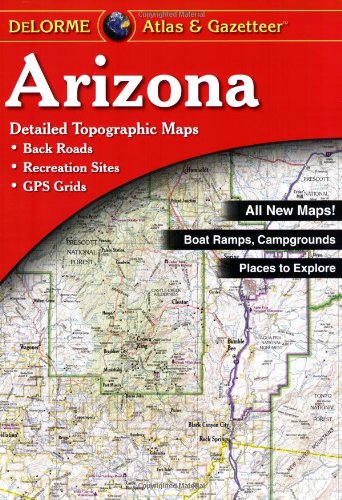
Unlike most travel map books that offer only broad overviews, the Arizona Atlas & Gazetteer by Delorme delivers an exceptionally detailed look at the state's geography. It covers everything from back roads and boat ramps to prime fishing spots and unique natural features, making it a practical companion for both casual explorers and serious outdoor enthusiasts. You get precise topographic details paired with categories like campgrounds and wildlife viewing, so planning anything from family outings to wilderness adventures becomes straightforward. This atlas suits anyone needing reliable navigation and local insights, though it may be less useful if you prefer digital maps or quick city guides.
by TailoredRead AI·
This tailored book explores proven navigation and travel map techniques designed to build your confidence on any journey. It covers essential map reading skills, route planning methods, and practical advice to help you navigate diverse terrains with ease. By focusing on your interests and travel goals, this book reveals the key elements of map mastery that millions of travelers have found valuable. The personalized content matches your background and desired sub-topics, ensuring a learning experience that feels relevant and engaging. Whether you’re tackling urban streets or wilderness trails, this book examines how to use maps effectively for safe and enjoyable travel.
![National Geographic Road Atlas 2025: Adventure Edition [United States, Canada, Mexico] book cover](https://m.media-amazon.com/images/I/51g+DvKGgYL._SL500_.jpg)
by National Geographic Maps··You?
by National Geographic Maps··You?
National Geographic Maps, tracing its roots back to 1915, crafted this Road Atlas: Adventure Edition to serve those ready to explore North America’s vast landscapes with confidence. This atlas goes beyond basic navigation by providing detailed maps of all 50 U.S. states plus Canada and Mexico, enriched with inset city maps highlighting popular attractions and infrastructure. What truly sets it apart are the curated guidebook-style recommendations covering the top 100 adventure destinations and the 24 most visited National Parks, making it a practical tool for planning your next road trip. If you appreciate thorough cartography combined with travel insights, this atlas offers a blend of precision and inspiration for both casual travelers and dedicated adventurers.

by Bjorn Kjellstrom, Carina Kjellstrom Elgin··You?
by Bjorn Kjellstrom, Carina Kjellstrom Elgin··You?
Bjorn Kjellstrom's decades as a Swedish orienteering champion and innovator in compass design led to this guide, which teaches you how to navigate confidently without relying solely on GPS. You'll learn to interpret map symbols, find bearings, and combine map and compass use effectively, with updated chapters addressing GPS technology and online resources. Whether you're a scout leader, hunter, or weekend hiker, the book walks you through practical skills like sketching maps and traveling in the wilderness, making it a solid foundation for anyone spending time outdoors. Its straightforward style keeps the focus on usable navigation techniques rather than overwhelming theory.

by Michelin·You?
by Michelin·You?
Michelin's Italy Road Atlas offers more than just maps; it reflects a deep understanding of road travel and navigation needs. The atlas simplifies route planning with clear locator maps and detailed city center layouts, making it easier to visualize your journey from broad regions down to local streets. Each year, Michelin's dedicated teams update the maps to maintain accuracy, including carefully selected scenic drives that invite exploration beyond the usual routes. If your travels demand reliable, easy-to-use navigation aids that highlight both practicality and discovery, this atlas provides that balance without overwhelming with unnecessary details.
by TailoredRead AI·
by TailoredRead AI·
This personalized travel map book offers a tailored journey through step-by-step map techniques designed to accelerate your travel planning skills. It explores essential mapping concepts, practical navigation methods, and custom strategies aligned with your background and travel goals. By focusing on your interests, the book reveals efficient ways to interpret and utilize travel maps, helping you plan trips with increased confidence and clarity. Combining reader-validated knowledge with your unique preferences, it examines route selection, spatial awareness, and map reading essentials in a way that matches your level and ambitions. This tailored guide transforms the process of mastering travel maps into an engaging, accessible experience that fits your learning pace and objectives.

by Rand McNally··You?
by Rand McNally··You?
What started as a century-old mission to aid travelers evolved into this 2025 edition by Rand McNally, designed to make navigation straightforward with large-print maps that cover every U.S. state, Canadian province, and Mexico. You gain clear insights into distances and driving times between hundreds of cities, plus handy inset maps of over 50 North American cities, all in a travel-friendly spiral-bound format. The atlas also offers curated tips on mountain retreats, complete with lodging and activity suggestions, reflecting its practical focus on supporting your journeys. If you seek a reliable companion for road trips, this atlas suits you best, though digital map users may find it less dynamic.

by Lonely Planet··You?
by Lonely Planet··You?
Lonely Planet has long been a trusted name in travel, and this Italy Planning Map exemplifies their expertise. Designed with durability and user-friendliness in mind, it offers waterproof material, an easy-fold format, and a handy slipcase, making it practical for travelers on the go. Beyond basic navigation, it enriches your journey with detailed town indexes, regional highlights, transport guides, and themed lists that help you plan efficiently. Whether you're exploring Rome's historic streets or the scenic Italian Lakes, this map equips you with both orientation and cultural context, ideal for those eager to explore Italy beyond typical tourist paths.

by Rand McNally··You?
by Rand McNally··You?
What started as a commitment to outdoor exploration led Delorme to craft an atlas that goes beyond standard maps, offering you an immersive guide to Florida's diverse landscapes. This atlas provides detailed topographic maps, complete with indexes covering towns, historic sites, and recreation spots like trailheads and fishing locations, enabling precise navigation with GPS overlays. If you’re someone who ventures beyond highways into the backcountry or seeks to uncover hidden gems in Florida’s outdoors, this book equips you with the localized knowledge to do so confidently. Whether planning a scenic drive or a fishing trip, you’ll find the maps rich with practical details that bring the state’s geography to life.

by Benchmark Maps·You?
by Benchmark Maps·You?
Benchmark Maps challenges the conventional wisdom that a travel atlas can only be a simple navigation tool by offering an immersive experience of Montana's diverse landscapes. You’ll gain a deep understanding of the state's geography with large-scale Landscape Maps™ that vividly detail rugged mountains, rivers, and plains, alongside an insightful 15-page Recreation Guide that categorizes outdoor activities by region. This atlas suits anyone planning to explore Montana’s wilderness, from casual travelers to seasoned outdoor enthusiasts, providing reliable, field-verified data that supports both trip planning and on-the-ground navigation. For example, the detailed regional maps with public land information help you discover hidden spots for hiking or fishing beyond the usual routes.
Recommended by The New York Times
“Fodor’s is pitched a few notches higher….aimed at a fairly discerning traveler with an appetite for background and the occasional surprise.” (from Amazon)

by Fodor’s Travel Guides··You?
by Fodor’s Travel Guides··You?
What happens when decades of local expertise meet the challenge of capturing Japan's diverse travel landscape? Fodor's Travel Guides deliver a richly detailed resource that goes beyond basic sightseeing tips, offering you immersive experiences from Tokyo's sushi scene to Okinawa's beaches. You'll find over 50 maps and thoughtfully curated itineraries that help you navigate efficiently while uncovering hidden gems recommended by locals. The inclusion of cultural primers and language essentials means this guide supports more than just logistics—it enriches your understanding of Japan’s history, art, and cuisine, making it a solid choice if you want both practical navigation and cultural insight.
Proven Travel Maps, Personalized for You ✨
Get expert-validated travel map methods tailored to your journey and interests.
Validated by thousands of travel enthusiasts and expert recommendations
Conclusion
This collection of 10 Travel Map books offers a rich spectrum of proven frameworks and trusted guidance, spanning from detailed national park atlases to comprehensive road maps and cultural travel guides. If you prefer established methods that have helped countless travelers, starting with National Geographic Atlas of the National Parks or National Geographic Road Atlas 2025 is a reliable choice. For those seeking validated approaches that blend practical navigation with cultural insights, Fodor's Essential Japan and Be Expert with Map and Compass complement each other well.
Alternatively, you can create a personalized Travel Map book that fuses these proven strategies with your specific travel interests and skill level. These widely-adopted approaches have helped many readers succeed in navigating with confidence and enriching their travel experiences.
Frequently Asked Questions
I'm overwhelmed by choice – which Travel Map book should I start with?
Start with the National Geographic Atlas of the National Parks if you're interested in U.S. parks, or National Geographic Road Atlas 2025 for broad road trip planning. These provide solid foundations and are highly recommended by experts.
Are these books too advanced for someone new to Travel Map?
Not at all. Books like Be Expert with Map and Compass teach foundational navigation skills clearly, making them great for beginners looking to build confidence in map reading.
What's the best order to read these Travel Map books?
Begin with general atlases like National Geographic's, then explore specialized guides such as Fodor's Essential Japan or Michelin Italy Road Atlas to deepen regional knowledge.
Do I really need to read all of these, or can I just pick one?
You can pick based on your travel focus. For example, choose a national atlas for broad travel or a regional guide like Arizona Atlas & Gazetteer for detailed local navigation.
Which book gives the most actionable advice I can use right away?
Be Expert with Map and Compass offers practical skills for immediate use, especially if you want to improve your navigation beyond GPS reliance.
Can personalized Travel Map books complement these expert recommendations?
Yes! While expert books cover proven methods, personalized Travel Map books tailor insights to your unique goals and skills. Learn more about creating your own Travel Map book.
📚 Love this book list?
Help fellow book lovers discover great books, share this curated list with others!
Related Articles You May Like
Explore more curated book recommendations