8 United States Map Books That Shape How You See America
Discover insights from Jonathan Waterman, Rand McNally cartographers, and Benchmark Maps on United States Map books
What if your next journey across the United States could be guided by maps that do more than show roads — maps that tell stories, reveal hidden landscapes, and unlock the secrets of national parks? The world of United States Map books is richer than you might expect, blending precise cartography with history, nature, and adventure.
Jonathan Waterman, a former park ranger turned author, has spent years immersed in the wilderness, crafting maps that capture more than geography — they capture experience. Alongside him, Rand McNally's cartographers bring over a century of expertise, creating atlases that travelers trust for clarity and accuracy. Benchmark Maps offers a fresh take on road and recreation mapping, especially for Oregon's diverse terrain. Their combined work shapes how you explore and understand America.
While these expert-curated books provide proven frameworks, readers seeking content tailored to their specific travel routes, interests in national parks, or recreational activities might consider creating a personalized United States Map book that builds on these insights and fits your unique journey.
Recommended by National Geographic
“National Geographic’s Atlas of the National Parks showcases these natural treasures through photographs, maps, and graphics.” (from Amazon)

by Jon Waterman··You?
by Jon Waterman··You?
Jonathan Waterman, a seasoned adventurer and former park ranger, brings a deeply personal touch to this atlas, born from his years immersed in America's wilderness. You'll discover richly detailed maps paired with insightful chapters that spotlight each park's unique landscapes, wildlife, and history, such as the intricate ecosystems of Denali or the sandy shores of Dry Tortugas. This book offers more than cartography; it builds your understanding of natural heritage through vivid photographs and thoughtful commentary. If you’re fascinated by America’s national parks and want a resource that combines geography with storytelling, this atlas will enhance your appreciation and knowledge.

Unlike most map books that focus on broad overviews, Rand McNally's 2025 Large Scale Road Atlas zeroes in on practical usability with maps that are 35% larger than standard editions. This atlas delivers detailed layouts for every U.S. state, Canada, and an overview of Mexico, along with 375 city insets and 28 national parks, making navigation straightforward whether you're planning a cross-country trip or exploring local roads. You gain access to specific features like road construction updates and driving times between major cities, all presented in a durable spiral-bound format that stays open flat. If you value precise, accessible cartography that supports both casual and serious travelers, this book suits your needs well.
by TailoredRead AI·
This tailored book explores the intricate art of navigating and understanding United States maps, crafted specifically to match your interests and background. It reveals how to interpret diverse map types, read geographic symbols, and grasp spatial relationships, all focused on your unique goals for mastering American cartography. With a personalized approach, it uncovers the complexities of regional features, transportation networks, and natural landmarks, providing a clear pathway through vast expert knowledge. This book combines detailed map reading techniques with customized insights, making the navigation of the United States both accessible and engaging.
by Rand McNally··You?
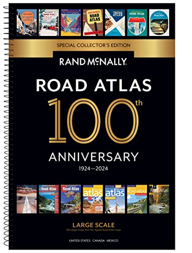
Rand McNally has crafted this 100th Anniversary Collector's Edition Large Scale Road Atlas to mark a century of guiding travelers across North America. You’ll find maps of every U.S. state, expanded Canadian and Mexican coverage, plus over 350 detailed city insets and national park maps, all 35% larger than their standard editions for easier reading. Practical features like road construction updates, mileage charts between major cities, and a spiral binding that lays flat make it a useful tool for anyone planning detailed road trips. Whether you’re a frequent traveler or a map enthusiast, this atlas offers precise navigation aids rooted in a legacy of cartographic expertise.
by Rand McNally··You?
Drawing from over 150 years of cartographic expertise, Rand McNally delivers a meticulously updated atlas that goes beyond simple road maps. You’ll find detailed layouts of every U.S. state, Canadian province, and a comprehensive overview of Mexico, along with inset maps of more than 350 cities and 25 national parks. The inclusion of practical features like road construction updates, mileage charts, and driving times transforms this atlas into an indispensable tool for travel planning. If your journeys require reliable navigation across North America, this edition equips you with precise geographic insights and historical context, such as the "National Parks by Decade" feature that illuminates the evolution of these treasured sites.
by Rand McNally··You?
by Rand McNally··You?
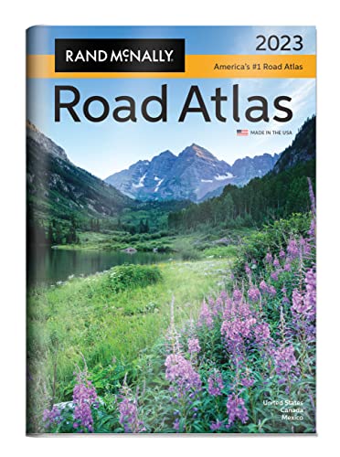
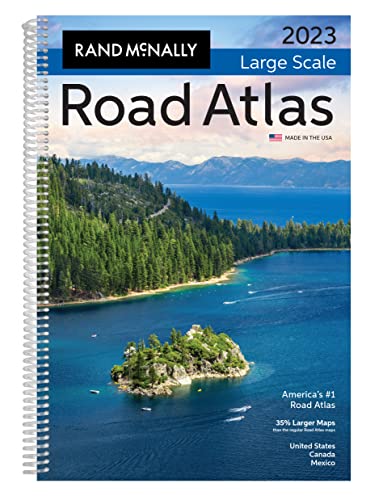
Rand McNally, with over a century of expertise in cartography and travel information, delivers a meticulously detailed atlas designed to ease navigation across North America. This 2023 Large Scale Road Atlas expands on their trusted maps by enlarging every U.S. state map by 35%, incorporating more than 350 city and national park insets, and integrating practical features like road construction updates and mileage charts. You’ll find it especially useful if you’re planning extensive road trips or need precise, easy-to-read maps for travel planning. Its spiral binding and comprehensive index make it a handy companion for both seasoned travelers and those discovering road navigation essentials.
by TailoredRead AI·
by TailoredRead AI·
This tailored book explores a personalized 30-day journey to mastering road travel across the United States. It covers essential navigation techniques, route planning, safety considerations, and travel logistics, all matched to your background and interests. By focusing on your specific goals and preferred destinations, it reveals how to build confidence and independence behind the wheel. The book examines practical aspects such as map reading, itinerary design, and local insights, providing a clear, step-by-step guide that suits your unique travel style. This personalized approach helps you grasp complex travel concepts efficiently, transforming theory into actionable knowledge shaped around your needs.

The Rand McNally 2024 Road Atlas emerged from a century of cartographic expertise, tracing its roots back to the original Auto Chum in 1924. This collector’s edition offers you not just updated maps but a rich historical perspective, featuring vintage covers and a nostalgic look at roadside culture and the evolution of highways. You’ll find detailed maps of every U.S. state, Canadian province, and major cities, plus practical tools like mileage charts and contact info for road conditions. If you’re someone who values both the history and practicality of road travel, this atlas integrates them thoughtfully, though it’s less for casual map users and more for dedicated travelers and history enthusiasts.
by Rand McNally··You?
by Rand McNally··You?
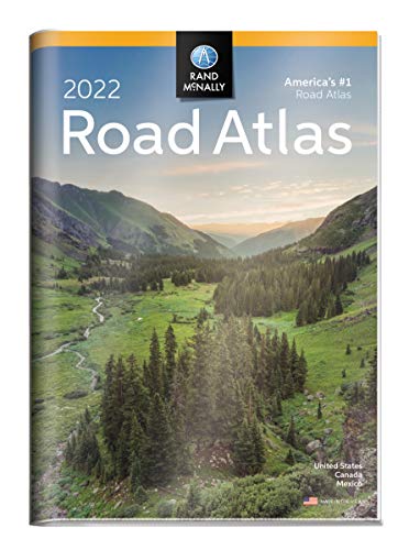
Rand McNally has been guiding travelers since the late 19th century, and this 2022 Road Atlas reflects their deep commitment to mapmaking expertise. You’ll find detailed maps covering every U.S. state, Canadian province, and an overview of Mexico, enhanced by over 350 city insets and 25 national parks. The atlas goes beyond geography, offering mileage charts, driving times, and contact information for road conditions, making it a reliable companion for planning and navigating road trips. If you rely on precise, clear cartographic details and practical travel information, this atlas provides a solid foundation for your journeys across North America.

by unknown author··You?
by unknown author··You?
Drawing from a rich collaboration between three established mapping firms, Benchmark Maps crafted this Oregon Road & Recreation Atlas to meet the needs of travelers and outdoor enthusiasts seeking detailed, reliable cartographic information. You’ll find a distinctive blend of visually appealing Landscape Maps™ paired with meticulously accurate data, designed to help you navigate Oregon’s roads and recreational areas with confidence. This atlas caters especially well to those who value both aesthetic appeal and functional precision, such as hikers, cyclists, and road trippers. While it doesn’t provide exhaustive narrative content, its thoughtfully layered maps empower you to explore Oregon’s diverse terrain effectively.
Get Your Personal United States Map Strategy ✨
Stop guessing with generic maps. Get tailored navigation and insights fast.
Trusted by travel experts and cartography enthusiasts worldwide
Conclusion
These eight books reveal the many faces of United States maps—from the grandeur of national parks to the practical needs of road travelers and outdoor enthusiasts. If you’re planning a deep dive into America’s natural treasures, start with Jonathan Waterman’s atlas for rich context and vivid maps. For dependable road navigation across the continent, Rand McNally’s atlases offer trusted precision and practical features.
Outdoor adventurers and locals will appreciate Benchmark Maps’ detailed recreation atlas focused on Oregon’s trails and roads. Combining these resources can elevate your understanding and enjoyment of the landscape.
Alternatively, you can create a personalized United States Map book to bridge the gap between general principles and your specific situation. These books can help you accelerate your learning journey and deepen your connection with America’s geography.
Frequently Asked Questions
I'm overwhelmed by choice – which book should I start with?
Start with the National Geographic Atlas of the National Parks for vivid storytelling combined with detailed maps. It sets a solid foundation before exploring road atlases for broader navigation.
Are these books too advanced for someone new to United States Map?
Not at all. Books like Rand McNally's atlases offer clear, easy-to-understand maps suitable for beginners and seasoned travelers alike.
Should I start with the newest book or a classic?
Newer editions, like Rand McNally's 2025 Large Scale Road Atlas, offer updated maps and features, but classics like Waterman's atlas provide timeless insights into national parks.
Do I really need to read all of these, or can I just pick one?
You can pick based on your needs. If you focus on national parks, Waterman’s atlas is ideal; for road trips, Rand McNally’s atlases serve better.
Which books focus more on theory vs. practical application?
Waterman's atlas leans toward immersive exploration and natural history, while Rand McNally and Benchmark Maps emphasize practical navigation and road details.
How can I get United States Map insights customized to my specific needs?
While these recommended books offer expert knowledge, personalized United States Map books can tailor insights to your unique routes and interests. Consider creating a custom book for focused guidance that complements expert recommendations.
📚 Love this book list?
Help fellow book lovers discover great books, share this curated list with others!
Related Articles You May Like
Explore more curated book recommendations